Temperature and Rainfall Statistics
|
|||||||||
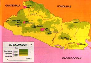
| El Salvador Central Highlands
Coast
|
|||||||||
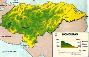
| Honduras Highlands
Mosquito Coast
|
|||||||||
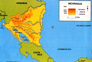 |
Nicaragua Central Highlands
Mosquito Coast
|
||||||||
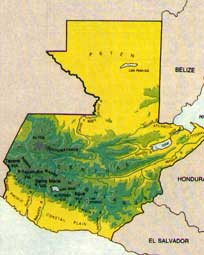 |
Guatamala Central Highlands
Coast
|
||||||||
Temperature and Rainfall Statistics
|
|||||||||
| El Salvador Central Highlands
Coast
|
|||||||||
| Honduras Highlands
Mosquito Coast
|
|||||||||
|
Nicaragua Central Highlands
Mosquito Coast
|
||||||||
|
Guatamala Central Highlands
Coast
|
||||||||
Top Introduction Weather Patterns Rainfall and Temperature